
Fisherman’s Point Trail and Day Use Area
Views that you can’t experience anywhere else!
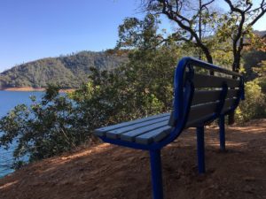
The Fisherman’s Point Day Use and Picnic area is located near Shasta Dam. Exit I-5 at Shasta Dam Boulevard. You will come to a four-way stop after you go through the City of Shasta Lake. Turn right and follow Lake Boulevard towards Shasta Dam and the Centimudi Boat Ramp.
Enjoy this 2.00 mile, out and back trail near Redding, California. Generally considered an easy route. This trail is great for fishing, hiking, and mountain biking. Dogs are welcome and may be off leash in some areas. This hike is a shorter trail but has all the views to make it worth a trip.
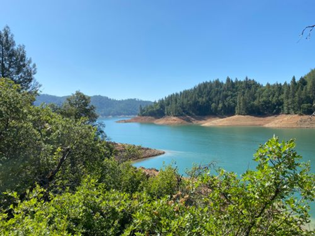
Bailey Cove Trail
See the McCloud Arm from a different view!
From I 5, take exit 695 OBrien/Shasta Caverns exit. Turn right at end of off ramp. Continue along Shasta Caverns road for four tenths of a mile to the Bailey Cove junction on the right side of the road. Turn right and follow road about six tenths of a mile to the day use area on the left in the upper parking lot.
Bailey cove trail is an easy path that weaves along the edges of coves along Shasta Lake specifically the McCloud arm of the lake. This trail is covered with shade making it kids and animal friendly in the summer heat. It is a single-track dirt path. There is a day use fee, but because this hike is within the Shasta Trinity Forest your national park pass can be used instead of paying the fee. Dogs and bikes are allowed on this trail.
Chamise Trail
Peak at Chamise!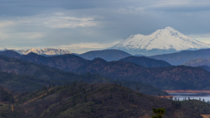
Come check out this out and back trail near Shasta Lake, California. Generally considered a moderately challenging route. This is a very popular area for hiking, horseback riding, and mountain biking, so you’ll likely encounter other people while exploring. Dogs are welcome and may be off leash in some areas. Start at Shasta Dam Enter the Trailhead for the Sacramento Ditch Trail. This will lead you to the Chamise Peak Trail head. All together this hike is about 10 miles out and back.
If you want a 360-degree view of all things Shasta (Shasta Dam, Shasta Lake, Mount Shasta, and City of Shasta Lake), look no further. This highest spot atop the mountainous spine separating Keswick Reservoir from the City of Shasta Lake affords expansive views of the upper Sacramento Valley, the Sacramento River canyon below Shasta Dam and the western mountains.
Sacramento River Trail
Experience the beauty the city of Redding has to offer!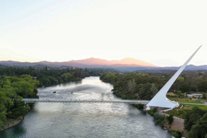
To find this trail you will want to park at Turtle bay in Redding CA. From there you will start at the Sundial Bridge. There are different trails you can take from the sundial bridge just depending on the views and the length of trail that you want to experience. If you decide to do the River trail you may see turtles, ducks, and geese. Gorgeous views of the Sacramento River are unmatched! The trails here are paved. This trail is open year-round, dog friendly but they must stay on a leash.

